Researchers from Instituto Juruá carry out the last expedition for capturing free-living alligators and arapaimas for the installation of satellite transmitters as part of the Guardiões dos Rios project.
By Eduardo von Mühlen
Translated by Laiane Lessa
In the Amazonian region, the water cycle promotes a real in sync dance with the forest. The rivers overflow during the rainy season, flooding the forest and fertilizing the soil. As the dry season approaches, the rivers recede, exposing the lands that used to be submerged. This alternation not only shapes the landscape, but also influences the wildlife and local communities, representing the pulsating vitality of the region. This cycle is the aquatic symphony that sustains the exuberant biodiversity of the Amazon, which serves, today, as the main stage to the regulation and maintenance of the global climate.


The aquatic megafauna of the Amazon, which includes giant otter, the black caiman, the amazonian manatee, the amazonian river turtle, the pink river dolphin and the arapaima compose a collection of flagship species of great importance to the biome. They play a fundamental role in the culture, economy and ecology of the region. These species have been widely influenced by the seasonality of the rivers and share a long history of overexploitation, which, through time have caused serious collapses in their wild populations.
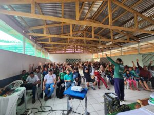
In this scenery, we initiated in 2021 the Guardiões dos Rios project: Conservação de Base Comunitária da Megafauna Aquática (Guardians of Rivers: Community-Based Conservation of Aquatic Megafauna), as part of the Perpetual Planet Amazonian Expeditions, promoted with the support of National Geographic and Rolex. The project aims to assess the spatial dynamic, habitat requirements and coexistence of these six species with human populations. The objective is to provide necessary scientific evidence to align biodiversity conservation with the well-being needs of local residents on a basin scale, embracing different scenarios and models of aquatic environmental conservation. Through this initiative, we intend to develop and implement a spatially explicit conservation model that can be effectively applied and led by local communities.
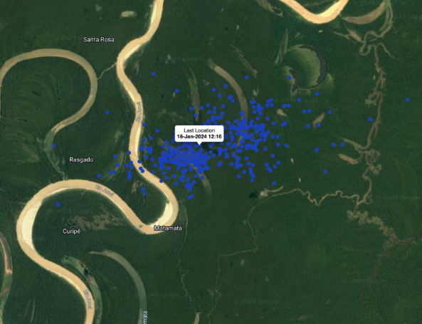
In the past month, December 2023, on the verge of water rise, researchers and technician from Instituto Juruá, in partnership with Roberto Avila, oceanographer and researcher, along with local collaborators, conducted the last expedition to install the movement satellite transmitters (GPS) in 6 arapaimas, 3 black caimans. These were located in 2 areas with different local conservation contexts: the São Raimundo community area in RESEX of Mid-Juruá, a federal conservation unit managed by ICMBio and regulated since 1997; and the Lago Serrado community, an area located outside the official boundaries of a conservation unit, however, relying on the Lower Carauari Fishing Agreement. This agreement represents another form of territorial protection, conducted by local initiative and communitarian management.
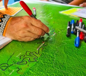
The main concept of this research component is to comprehend how these species move within the environment in function of differences of the hydrological cycle – when the water rises and the flooded forest becomes available – as well as in this different model of territorial management, such as conservation units and areas covered by fishing agreement.
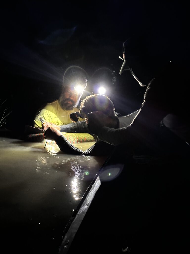
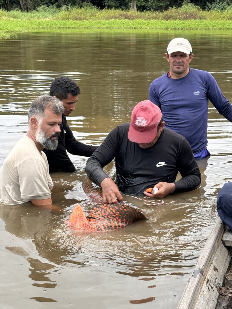
In total, there were 10 days of expedition, with 9 animals captured, in a great joint effort by the institute’s teams and local collaborators. The risks associated with working with live, wild aquatic animals, considering their size, always make this kind of research filled with challenges, – from the moment of capture up to the installation of satellite signal transceivers. This process is conducted without causing physical harm and ensures the well-being of the animals during the entire process of installation up until the post-release period, guaranteeing their survival and complete development.
According to initial data, eight of these animals (except for arapaima individuals, due to a device defect) keep broadcasting signals via satellite, demonstrating the success of the transmitter installation technique and the decision to pursue this approach. We look forward to tracking the movements of these individuals until, at least, the next water backflow, in the middle of 2024.